


Chemins de Stevenson-complet

nicolas54230
User

Length
274 km

Max alt
1699 m

Uphill gradient
8210 m
Km-Effort
385 km

Min alt
129 m

Downhill gradient
8737 m
Boucle
No
Creation date :
2018-06-26 14:28:16.008
Updated on :
2018-06-26 14:28:16.008
22h33
Difficulty : Difficult

FREE GPS app for hiking
 SityTrail
IGN / Geographical institutes
SityTrail Plus
The world is yours!
About
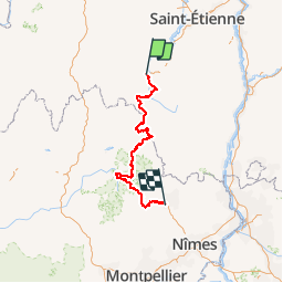
Trail Mountain bike of 274 km to be discovered at Auvergne-Rhône-Alpes, Haute-Loire, Le Puy-en-Velay. This trail is proposed by nicolas54230.
Description
Sources: Topoguides/Chamina Edition/FFR Randonnée
Positioning
Country:
France
Region :
Auvergne-Rhône-Alpes
Department/Province :
Haute-Loire
Municipality :
Le Puy-en-Velay
Location:
Unknown
Start:(Dec)
Start:(UTM)
569637 ; 4988400 (31T) N.
Comments